Introduction – Easy Notes
- India’s Position
- Lies entirely in the Northern Hemisphere.
- Main land: Latitudes 8°4’N to 37°6’N and Longitudes 68°7’E to 97°25’E.
- Tropic of Cancer (23°30’N) passes almost through the middle.
- Mainland & Islands
- Mainland has a north–south extent of 3,214 km and east–west extent of 2,933 km.
- Two groups of islands: Andaman & Nicobar (Bay of Bengal) and Lakshadweep (Arabian Sea).
- Area & Rank
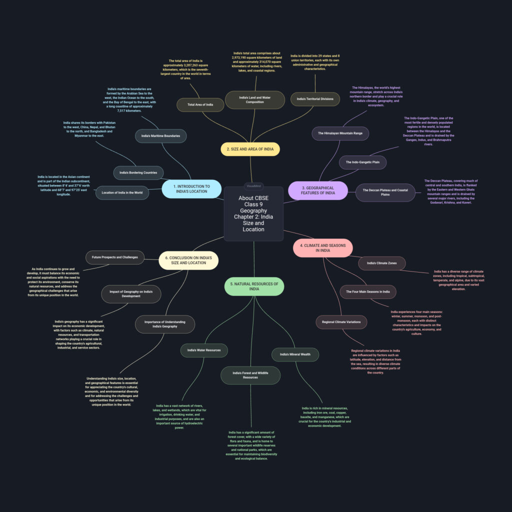
- Total area: 3.28 million sq. km (about 2.4% of the world’s land area).
- 7th largest country in the world.
- Neighbours
- North: China, Nepal, Bhutan.
- North-west: Pakistan, Afghanistan.
- East: Bangladesh, Myanmar.
- Sea neighbours: Sri Lanka, Maldives.
💡 Memory trick:
- “ChNaB PakAf BanMya” → China, Nepal, Bhutan, Pakistan, Afghanistan, Bangladesh, Myanmar.
- “Sea SL & M” → Sea neighbours: Sri Lanka & Maldives.
Location
- Position in the World
- India lies in the Northern Hemisphere and the Eastern Hemisphere.
- Located in south-central Asia, between the latitudes 8°4’N to 37°6’N and longitudes 68°7’E to 97°25’E.
- Tropic of Cancer
- 23°30’N passes almost through the middle of India.
- Divides India into two halves:
- Northern (Temperate)
- Southern (Tropical)
- Extent
- North–South: ~3,214 km
- East–West: ~2,933 km
- Time Difference
- Longitudinal extent causes about 2 hours difference between sunrise in Arunachal Pradesh and Gujarat.
- Indian Standard Time (IST) is based on 82°30’E longitude (passes through Mirzapur, Uttar Pradesh).
💡 Memory Tip:
- “82.5 is IST” → 82°30’E = Indian Standard Time.
- “Cancer Cuts” → Tropic of Cancer cuts India into two climatic zones.
Size
- Total Area
- 3.28 million sq. km → 2.4% of the world’s land area.
- 7th largest country in the world.
- Extent
- North–South: ~3,214 km
- East–West: ~2,933 km
- Land Boundaries & Coastline
- Land boundary: ~15,200 km
- Coastline (mainland + islands): ~7,516.6 km
- Shape & Stretch
- Compact and roughly triangular in shape.
- Latitudinal and longitudinal extent → influences climate, time, and culture.
💡 Memory Tip:
- 3.28 → 2.4 → 7 → Area in million sq. km → % of world → rank in world.
- “Land 15,200 – Coast 7,516” for boundary lengths.
India and the World
- Central Location
- India’s position in the Indian Ocean helps connect East Asia, South-East Asia, Africa, and Europe.
- Acts as a central link between the East and the West.
- Historical Connections
- Ancient trade routes (land & sea) carried spices, muslin, textiles, and ideas to the world.
- Cultural influences from India → other countries (e.g., Buddhism to Asia).
- Also received influences from outside (e.g., Greek architecture, Persian art).
- Modern Importance
- Sea routes across the Indian Ocean connect to Europe, Africa, and East Asia.
- Location benefits trade, cultural exchange, and strategic security.
💡 Memory Tip:
- “I – O – Link” → India – Ocean – Link between East & West.
- Think of India as the “Middle seat in Asia” — easy to connect with both sides.
India’s Neighbours
- Land Neighbours
- North: China, Nepal, Bhutan
- North-West: Pakistan, Afghanistan
- East: Bangladesh, Myanmar
- Sea Neighbours
- South-East: Sri Lanka (separated by Palk Strait & Gulf of Mannar)
- South-West: Maldives (islands in the Indian Ocean)
- Neighbourhood Importance
- Shares land boundary of ~15,200 km.
- Maintains cultural, economic, and political ties.
- Part of SAARC (South Asian Association for Regional Cooperation).
💡 Memory Tip:
- “ChNaB PakAf BanMya” → China, Nepal, Bhutan, Pakistan, Afghanistan, Bangladesh, Myanmar.
- “Sea SL & M” → Sea neighbours: Sri Lanka & Maldives.